mirror of
https://github.com/opengeos/GeoLibre.git
synced 2026-11-06 15:42:11 +00:00
 Qiusheng Wu
38ed979d3b
* docs: review the docs against the code and fix drift

Check every docs page against the current code and correct what no
longer matches: menu paths and labels, plugin placement (most plugins
now open in a docked panel), Cesium ion tokens being optional, desktop
OAuth sign-in for sharing, browser project save/open, project schema
fields, server and collaboration endpoints, Python and MCP APIs, and
stale paths in the source-code deep dives.

Fix the Spatial SQL tutorial's ST_Area_Spheroid query, which needs
ST_FlipCoordinates for lat/lon axis order. Document the Settings
sections that were listed but never described (Language, Appearance,
Interface, Geocoding, AI Providers), and add the USGS NLDI and ArcGIS
feature editing pages to the nav.

* docs: keep the NLDI and ArcGIS editing pages out of the nav

* Address CodeRabbit review feedback

- collaboration.md: give both snapshot-cap defaults, 10 MB for the
  relay and 1 MB in the Docker Compose setup.
- features.md, cesium-renderer.md: without an Ion token the globe still
  gets terrain from keyless Terrarium elevation (or a configured COG),
  not a bare ellipsoid (cesium-engine.ts enableWorldTerrain).

* Address CodeRabbit review feedback

- project-format.md: type blankBackgroundColor and selectedLayerId as
  string | null, matching ProjectFile in packages/core/src/types.ts.
61 lines
2.9 KiB
Markdown
61 lines
2.9 KiB
Markdown
# Spatial SQL
|
|
|
|
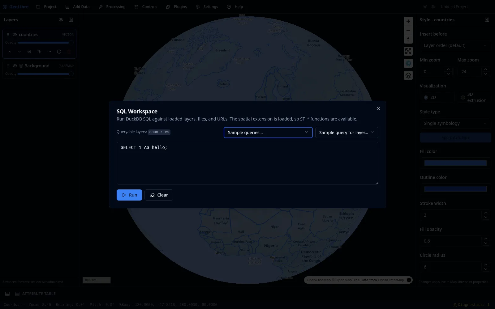
The [SQL Workspace](../user-guide/sql-workspace.md) lets you analyze data with DuckDB Spatial SQL and add the results to the map. It runs on DuckDB-WASM, so it works in the browser as well as the desktop app. Open it from **Processing → SQL Workspace**.
|
|
|
|
## 1. Query a loaded layer
|
|
|
|
Every loaded vector layer is a queryable table. Load the sample countries layer (see [Your First Map](first-map.md)), then run:
|
|
|
|
```sql
|
|
SELECT NAME, CONTINENT, GDP_MD_EST
|
|
FROM countries
|
|
ORDER BY GDP_MD_EST DESC
|
|
LIMIT 10;
|
|
```
|
|
|
|
Click **Run** to see the ten countries with the highest estimated GDP.
|
|
|
|
|
|
|
|
!!! note "Sample dataset columns"
|
|
`NAME`, `CONTINENT`, `POP_EST`, and `GDP_MD_EST` are Natural Earth field names in the sample `countries.parquet`, whose geometry column is `geom`. A different dataset will have its own column names. To discover them, run `DESCRIBE SELECT * FROM 'your-file-url'` first.
|
|
|
|
## 2. Query a remote file directly
|
|
|
|
You do not have to load a file first. The Workspace detects a bare URL in a `FROM` clause and wraps it in the right reader automatically, then streams the file over HTTP range requests so you do not download it in full. This bare-URL shorthand is a SQL Workspace convenience; in the standard DuckDB CLI you would write `read_parquet('https://...')` explicitly.
|
|
|
|
```sql
|
|
SELECT COUNT(*) AS n
|
|
FROM https://data.source.coop/giswqs/opengeos/countries.parquet;
|
|
```
|
|
|
|
## 3. Use spatial functions
|
|
|
|
The spatial extension is loaded, so `ST_*` functions are available. For example, compute area and keep the `geom` column so the result can be mapped:
|
|
|
|
```sql
|
|
-- area is in square degrees because the data is in EPSG:4326;
|
|
-- the ranking is valid, but for km2 use
|
|
-- ST_Area_Spheroid(ST_FlipCoordinates(geom)) / 1e6 (it expects lat/lon order).
|
|
SELECT NAME, ST_Area(geom) AS area, geom
|
|
FROM https://data.source.coop/giswqs/opengeos/countries.parquet
|
|
WHERE CONTINENT = 'Africa'
|
|
ORDER BY area DESC;
|
|
```
|
|
|
|
## 4. Add the result to the map
|
|
|
|
When a query returns a geometry column, click **Add as layer** to create a new layer from the result, optionally naming it. The result layer supports [identify, selection, and the attribute table](../user-guide/attribute-table.md) like any vector layer, and you can add several result layers at once.
|
|
|
|
## 5. Export
|
|
|
|
Export the query result as **CSV** or **GeoParquet** straight from the workspace — the **Export CSV** and **Export GeoParquet** buttons sit beside **Add as layer**. See [SQL Workspace](../user-guide/sql-workspace.md).
|
|
|
|
!!! tip "Sample queries and history"
|
|
Use the **Sample queries…** menu to start from a working query, and **History…** to rerun a previous one.
|
|
|
|
## Next steps
|
|
|
|
- Do equivalent geometry operations with the menu-driven [Vector Analysis](vector-analysis.md) tools.
|
|
- Convert results to cloud-native formats in [Cloud-Native Data](cloud-native-data.md).
|